Got complex survey data piling up?
We’ll convert it into clean, compliant CAD drawings without the back-and-forth.
Outsourced CAD Drafting for Land Surveyors Across North America
Survey firms across North America trust Gsource to handle their drafting backlog - accurately, consistently, and without the cost of expanding in-house teams. Backed by 17+ years of experience, 350+ CAD specialists, and ISO-certified processes, we integrate directly into your workflow and deliver compliant, ready-to-submit drawings so your team stays focused on fieldwork and client relationships.
 9001:2015
  27001-2022
  19650-1:2018
  14001:2015
  45001:2018
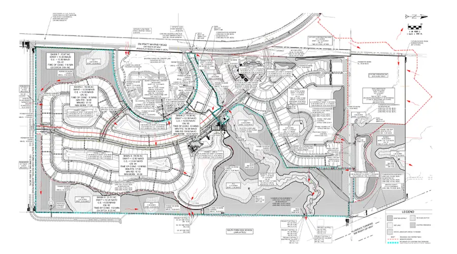
99% drafting accuracy with fully validated survey linework
24-hour turnaround available for select survey drafting projects
100% compliant drawings aligned with client and jurisdiction standards
Up to 40% reduction in rework through precise field-to-draft conversions
Conversion of field data into accurate boundary and topographic maps, supporting engineering drawings and helping define property lines, elevations, and terrain features.
Get tailored solutions to fit your project’s scale and complexity
Clearly defined deliverables & fixed-scope milestones.
Ongoing technical support & on-demand expertise.
High-volume multi-disciplinary, & long-term integration.
Adaptive workflows & complex, evolving project requirements.
Multi-level QC for error-free as-built drawings.
Skilled professionals with deep industry experience.
Confidentiality maintained with strict protocols.
Precision and accuracy delivered on tight schedules.
High-quality services without breaking your budget.
Aligned with ISO 9001 and ISO 27001 for consistent quality.
Single point of contact with real-time updates throughout the project.
Clean, organized files with quick help for any updates after delivery.
We’ll convert it into clean, compliant CAD drawings without the back-and-forth.
Get expert support to streamline your next project.

Free Initial Consultation - No Commitment Required

Secure and Confidential Project Information

17+ Years of AEC Expertise

450+ Drawing Deliverables Daily

Industry Standards Compliance Guaranteed
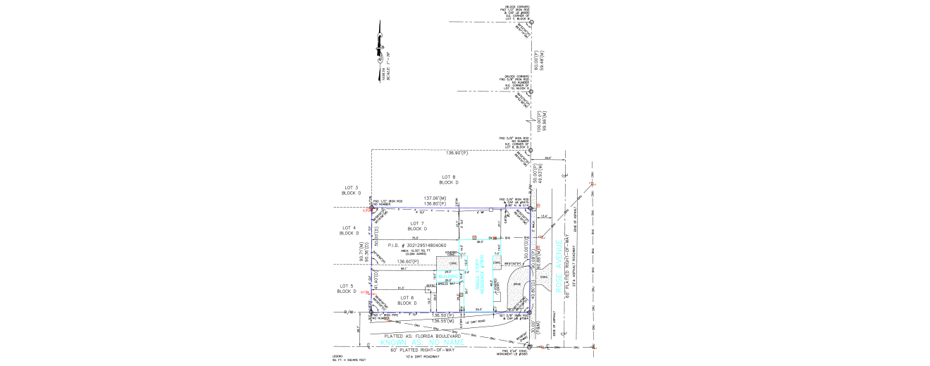
CAD drafting helps Boundary Surveys through precise digital mapping of property lines, corners, easements, and adjoining features. This results in clear, accurate survey drawings that support property ownership documentation and informed land development decisions.
We provide complete CAD drafting support for Boundary, Topographic, ALTA/NSPS Land Title, Mortgage, Commercial Boundary, Subdivision Surveys, LiDAR data processing, CAD Conversion, and GIS Mapping. Our team uses advanced tools and standardized workflows to ensure accuracy, clarity, and consistency.
We draft CAD deliverables for a wide range of survey types. These include Boundary, Topographic, Utilities, ALTA/NSPS, Commercial, and Subdivision Surveys. For residential, commercial, industrial, or infrastructure-related projects, we tailor drawings to your specific project requirements.
Our drafting process follows strict industry standards, multi-level quality control checks, and standardized linework conventions. Each deliverable is reviewed by experienced supervisors to verify precision, completeness, and regulatory compliance.
Turnaround times depend on project complexity, scope, and data availability. We work closely with clients to define realistic timelines and consistently meet agreed-upon deadlines. Expedited delivery is available for select projects.
Pricing varies based on project size, complexity, and required deliverables. We offer transparent, competitive rates with no hidden charges. Our team provides customized quotations aligned with your project needs and budget.
Our team stays current with regional surveying standards, local codes, and industry updates. We follow all mandated procedures and maintain coordination with relevant authorities to ensure every drawing meets legal and jurisdictional requirements.
With 16+ years of experience and a team of 350+ highly skilled survey drafters and technologists, Gsource has delivered thousands of precise, code-compliant survey drawings for clients across multiple regions and project types.
You can contact our team directly or submit the inquiry form below. We’ll schedule a consultation and understand your requirements. We will then guide you through the onboarding and project initiation process.
(Enter captcha image text in box)