Complex site or tight entitlement deadline?
Get fully coordinated, permit-ready land development plans on time.

Gsource provides comprehensive land development design services trusted by civil engineers, planners, and developers worldwide. With 17+ years of experience and a skilled multidisciplinary team, we deliver accurate site plans, grading designs, utility layouts, and construction drawings that streamline approvals, reduce rework, and keep your projects moving smoothly from concept to construction.
 9001:2015
  27001-2022
  19650-1:2018
  14001:2015
  45001:2018
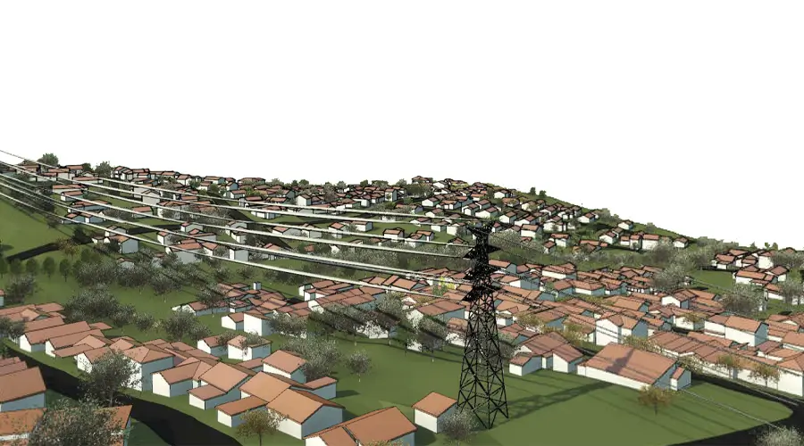

40% faster permitting turnaround
<5% change-order variance
24/7 project support and communication
100% code-compliant approval-ready plan sets
20-30% lower earthwork costs through optimized design
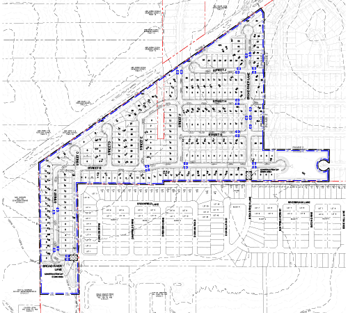
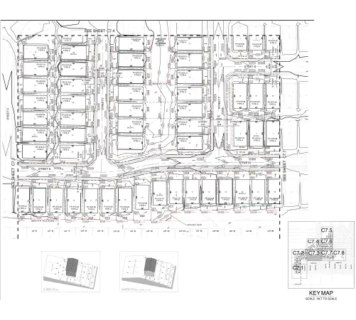
Complete land development design services from concept to construction-ready drawings. Turn raw land into buildable, compliant, and constructible sites with coordinated design and full documentation. From plot divisions and street layout to grading, drainage, utilities, ESC/BMPs, and permit-ready plans, the team handles every detail so field crews can build without surprises.
Site elevation modeling for cut/fill
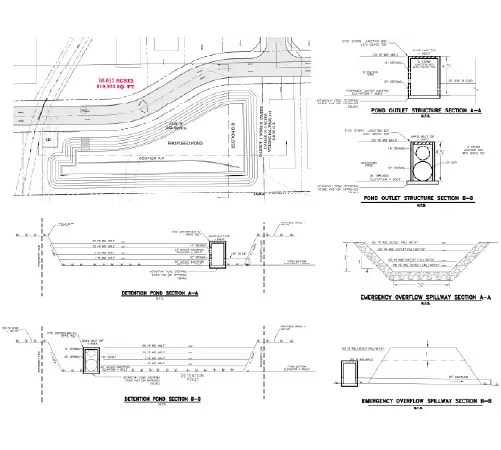
Grading plan
Outfall analysis
Site grading and slope management
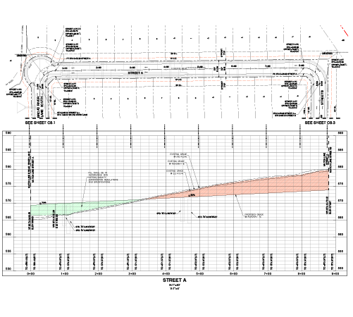
Street and access layout design
Right of Way (ROW) setbacks and open spaces
Sight distance plan and profiles
Road and pipe profiles
Integration of road hierarchy and lot numbering
Sediment management
Environmental mitigation
Regulatory compliance
Green space amenities and buffer zone placement
Water sewer and electric line routing
Underground utility corridor layout
Utility plan and profiles
Sanitary sewer plan and profile
Outfall analysis
Stormwater runoff and slope direction mapping
Drainage layout and utility trench planning
Swales berms and retention area detailing
Stormwater management plan
BMP (Best Management Practices) plan
Erosion and sediment control plan
Stormwater runoff and slope management
Plot divisions with area calculations
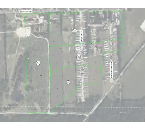
Land use zoning overlays and compliance
Integration of road hierarchy and lot numbering
Green space amenities and buffer zone placement
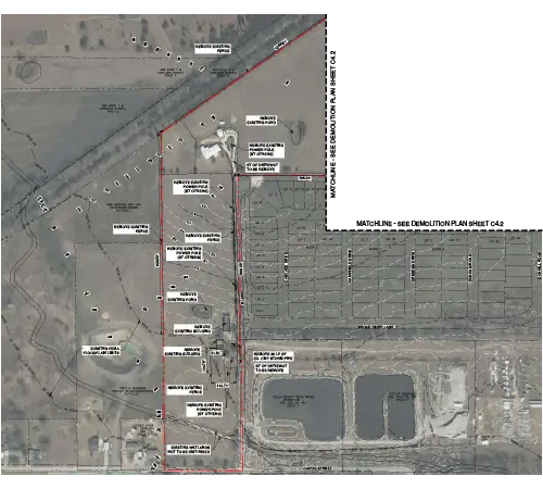
Existing conditions plan
Demolition plan
Detailed site plan
County standard site details
Permit-ready drawings
Construction documents
Specification coordination
Detail sheets
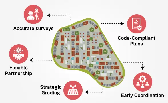
Get tailored solutions to fit your project’s scale and complexity
Clearly defined deliverables & fixed-scope milestones.
Ongoing technical support & on-demand expertise.
High-volume multi-disciplinary, & long-term integration.
Adaptive workflows & complex, evolving project requirements.

Multi-level QC for error-free as-built drawings.

Precision and accuracy delivered on tight schedules.

Scale your team up or down based on project demand.
Confidentiality maintained with strict protocols.
Every plan set aligned with local codes, regulations, and industry best practices.
Skilled professionals with deep industry experience.
High-quality services without breaking your budget.
Workflows backed by globally recognized quality and security standards.
Get fully coordinated, permit-ready land development plans on time.
Get expert support to streamline your next project.

Free Initial Consultation - No Commitment Required

Secure and Confidential Project Information

17+ Years of AEC Expertise

450+ Drawing Deliverables Daily

Industry Standards Compliance Guaranteed
They cover site planning, grading, drainage, utility layouts, roadway design, and permit-ready construction documents. These services ensure your project meets regulatory, functional, and engineering requirements.
We follow local codes, prepare complete submission-ready packages, and resolve potential red flags early. This reduces revisions and accelerates municipal review cycles.
Yes. Our team supports subdivisions, commercial sites, industrial facilities, mixed-use developments, and infrastructure improvements with scalable design and drafting support.
We work with AutoCAD Civil 3D, GIS platforms, and other industry-standard tools to deliver accurate, fully coordinated design and drafting outputs.
Every project passes through multi-layered QA checks, code-based validation, and peer review by experienced civil engineers. This ensures precision, compliance, and consistency across all deliverables.
(Enter captcha image text in box)