Need Accurate Civil Engineering Drawings On Time?
Partner with our expert design and drafting team today.

Your Trusted Partner for Precise, Permit-Ready Civil Plans
At Gsource, we convert your engineering concepts, surveys, and field data into precise, construction-ready civil drawings and models that accelerate project delivery. From land development and site design to utilities, grading, roadways, drainage, and earthwork modeling, our team ensures every plan is accurate, compliant, and aligned with your jurisdictional standards. With 17+ years of global experience, a 350+ multidisciplinary team, and ISO-certified production workflows, we provide end-to-end civil engineering design and drafting support.
 9001:2015
  27001-2022
  19650-1:2018
  14001:2015
  45001:2018
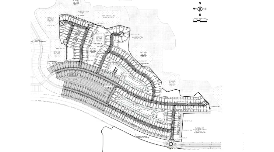
Up to 40% faster plan production through optimized drafting workflows
Code-compliant drawings aligned with local and regional standards
Accurate grading, drainage, and utility modeling for seamless construction coordination
Reduced rework and RFIs through detailed, clash-free designs
Flexible support models that adapt to your project pipeline and deadlines
Get tailored solutions to fit your project’s scale and complexity
Clearly defined deliverables & fixed-scope milestones.
Ongoing technical support & on-demand expertise.
High-volume multi-disciplinary, & long-term integration.
Adaptive workflows & complex, evolving project requirements.

Multi-level QC for error-free as-built drawings.

Precision and accuracy delivered on tight schedules.

Scale your team up or down based on project demand.
Confidentiality maintained with strict protocols.
Every plan set aligned with local codes, regulations, and industry best practices.
Skilled professionals with deep industry experience.
High-quality services without breaking your budget.
Workflows backed by globally recognized quality and security standards.
Partner with our expert design and drafting team today.
Get expert support to streamline your next project.

Free Initial Consultation - No Commitment Required

Secure and Confidential Project Information

17+ Years of AEC Expertise

450+ Drawing Deliverables Daily

Industry Standards Compliance Guaranteed
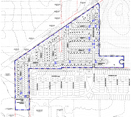
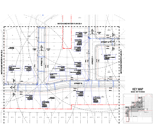
Gsource provides a wide range of civil engineering design services, including land development design and drafting, roadway network design, home building design, urban engineering design, utility layout, structural detailing, transportation planning, and stormwater drainage design.
To begin, we typically need surveys, zoning data, site constraints, client markups, and city standards. These help us ensure accurate planning, grading, and utility layouts.
You can request a custom quote by contacting Gsource with your site details, project scope, and design requirements. Our team will review the information and respond quickly.
Yes. Gsource offers full Urban Engineering Design services for commercial projects, including site planning, roadway access, parking design, utility planning, and stormwater systems.
Residential land development design includes site analysis, conceptual layouts, zoning checks, grading design, utilities, stormwater planning, and detailed construction drawings.
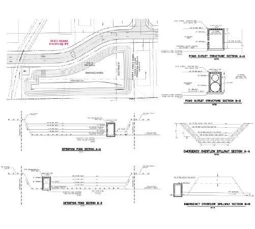
Yes. Our stormwater services include detention/retention design, drainage reports, grading plans, hydrology modeling, and utility drainage layouts.
Gsource provides 3D modeling, BIM coordination, Civil 3D surfaces, corridors, pipe networks, and 3D grading models to streamline construction and reduce field conflicts.
Absolutely. We prepare permit-ready drawings such as grading plans, utility plans, roadway sheets, erosion control plans, and stormwater details according to local code.
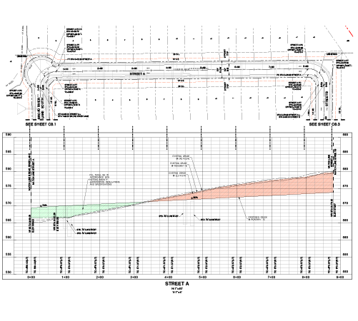
Yes. For large-scale Road Network Design projects, we provide the following: deliver comprehensive roadway design- subdivision streets, collector roads, plan and profile sheets, cross-sections, alignments, and corridor modeling.
You can schedule a consultation through our website or by phone. Our team will guide you through design requirements, timelines, and expected deliverables.
(Enter captcha image text in box)