


Need ALTA/NSPS Drafting Service You Can Rely On?
Talk to our survey drafting experts
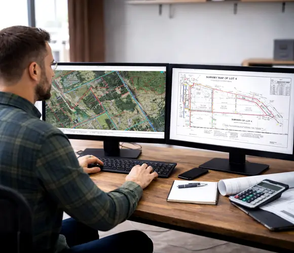
Outsourced CAD Drafting Support for Licensed Surveyors, Engineers, Lenders & Title Companies
At Gsource, we convert your ALTA/NSPS field data, point clouds, and survey notes into precise, regulation-ready CAD drafts and plats - so your team can focus on fieldwork while we handle the drafting. With 17+ years of global AEC expertise, a 350+ multidisciplinary team, ISO-certified workflows, we deliver end-to-end ALTA land survey drafting globally that ensures accuracy, clarity, and full adherence to national surveying standards.
 9001:2015
  27001-2022
  19650-1:2018
  14001:2015
  45001:2018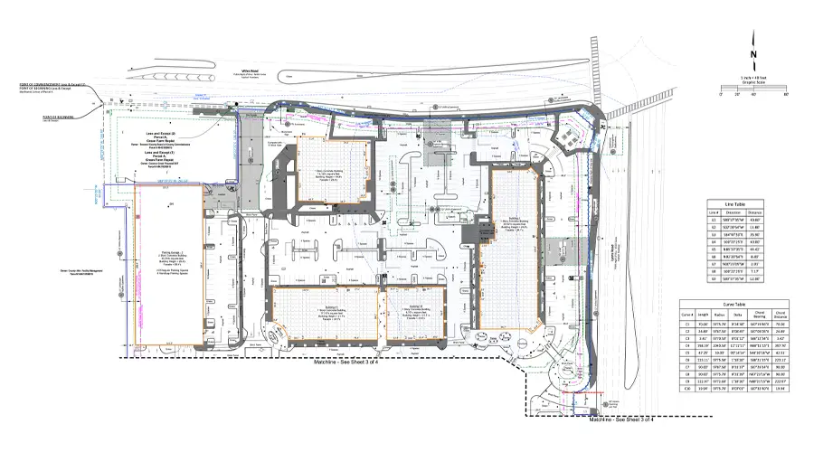

30% faster delivery of detailed ALTA/NSPS-compliant survey drafts

<2% variance in drafted boundary lines, easements, and improvements versus source survey data

24/7 collaboration with experienced land survey drafting specialists

100% compliance with ALTA/NSPS standards, zoning codes, and flood zone requirements

Up to 35% cost savings through accurate documentation and minimized rework


Precise drafting of total station point data, elevations, features, and measurements into ALTA-compliant boundary maps.

Drone-captured orthomosaic imagery processed and integrated into georeferenced base drafts for site analysis.

Clear drafting of boundary lines, adjoining parcels, and spatial limits from surveyor-provided data, per ALTA/NSPS standards.

Drafts showing all record documents, easements, and encumbrances referenced in the title commitment Schedule B.

Accurate drafting of structures, pavements, fences, and other improvements as documented in field data.

Documentation of visible and record-based utilities, ensuring accurate representation of service lines and easements.

Displays all public access points, ROW limits, and circulation elements impacting property access and legal compliance.

Precise drafting of monument and marker locations as recorded in your field survey data.
Get tailored solutions to fit your project’s scale and complexity

Clearly defined deliverables & fixed-scope milestones.

Ongoing technical support & on-demand expertise.

High-volume multi-disciplinary, & long-term integration.

Adaptive workflows & complex, evolving project requirements.
Talk to our survey drafting experts

Multi-level QC for error-free as-built drawings.

Skilled professionals with deep industry experience.

Confidentiality maintained with strict protocols.

Precision and accuracy delivered on tight schedules.

High-quality services without breaking your budget.

Aligned with ISO 9001 and ISO 27001 for consistent quality.

Single point of contact with real-time updates throughout the project.

Clean, organized files with quick help for any updates after delivery.
Get expert support to streamline your next project.

Free Initial Consultation - No Commitment Required

Secure and Confidential Project Information

17+ Years of AEC Expertise

450+ Drawing Deliverables Daily

Industry Standards Compliance Guaranteed
At Gsource, we combine advanced surveying technologies with ISO-certified drafting workflows for exceptional accuracy. Our team adheres strictly to ALTA and NSPS guidelines, thus providing precise, lender-ready survey drafts with minimal variance.
An ALTA/NSPS Land Survey Draft provides a highly detailed understanding of the property. It helps investors, developers, and lenders resolve boundary issues, identify encroachments, and verify land ownership limits. Gsource’s accurate drafts enable faster approvals and risk-free due diligence.
We typically require the legal description of the land, base drawing files, point cloud data (.txt/.csv), .ctb file, site photographs, FEMA maps, previous surveys, and adjacent property owner information. Additional inputs may be requested depending on the land characteristics and specific output requirements.
Time and cost calculation for ALTA/NSPS drafting depends on several factors. These include land size, input quality, complexity of improvements, and deliverables required. Gsource offers transparent pricing and optimized workflows to ensure fast turnaround with high accuracy.
An ALTA/NSPS survey remains valid until the property undergoes changes such as new construction, boundary modifications, or zoning updates. Lenders and title companies may also request updated surveys to ensure compliance and avoid future disputes.
Yes. Gsource specializes in ALTA/NSPS survey drafting for commercial real estate acquisitions. We provide boundary, zoning, and improvement details that streamline lender reviews and transaction approvals.
Absolutely. Our team is experienced in processing drone-based orthomosaic imagery, LiDAR scans, and point cloud datasets. Our experts excel at creating high-accuracy ALTA/NSPS survey drafts tailored to your project needs.
We follow the latest ALTA/NSPS standards, zoning regulations, FEMA guidelines, and local municipal codes. Every draft undergoes multi-level QC checks to ensure compliance, accuracy, and approval-readiness for lenders and title agencies.
Yes. By outsourcing to Gsource, firms benefit from 30–35% cost savings, reduced rework, and faster delivery cycles. They also get access to a dedicated team of expert survey drafters available 24/7.
We fully support Table A customization, including zoning information, flood zone classifications, topographic details, utilities mapping, and offsite improvements. Our team ensures each Table A item is drafted precisely as requested.
No. Gsource Technologies LLC is a drafting and CAD production company, we do not send surveyors to your site or collect field measurements. We work exclusively from field data (point clouds, total station data, title commitments, field notes) provided by your licensed surveying team, and convert it into ALTA/NSPS-compliant drafts, plats, and CAD deliverables.
(Enter captcha image text in box)