Blog

What Must Be Included in Fabrication Drawings for Signage Permit Approval
Imagine a signage project that looks perfect on the outside, the design is approved, brand elements are in place, and installation is scheduled. But one missing detail in fabrication drawings can bring the entire process to halt, be it small structural details or safety specifications.
Fri Jun 12, 2026

What Must Be Included in Fabrication Drawings for Signage Permit Approval
Imagine a signage project that looks perfect on the outside, the design is approved, brand elements are in place, and installation is scheduled. But one missing detail in fabrication drawings can bring the entire process to halt, be it small structural details or safety specifications.
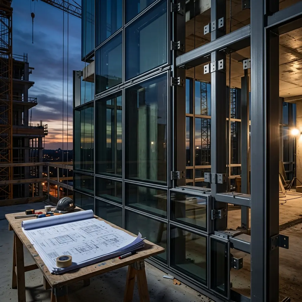
Why Curtain Wall Coordination Breaks Down Before Permit Stage, and How Teams Can Prevent It
Curtain wall coordination problems suddenly appearing during installation are rare. But these issues cropping up much earlier are more common than one might think. This is especially true during the pre-permit coordination stage. Initially, all the trades (architectural, structural, MEP, and facade) seem aligned well. But as designs evolve and deadlines tighten, small gaps between disciplines start surfacing. A shifted slab edge, an unresolved penetration, or an outdated consultant file may not seem critical initially, but these issues quickly snowball into RFIs, redesigns, and permit-stage delays later on.
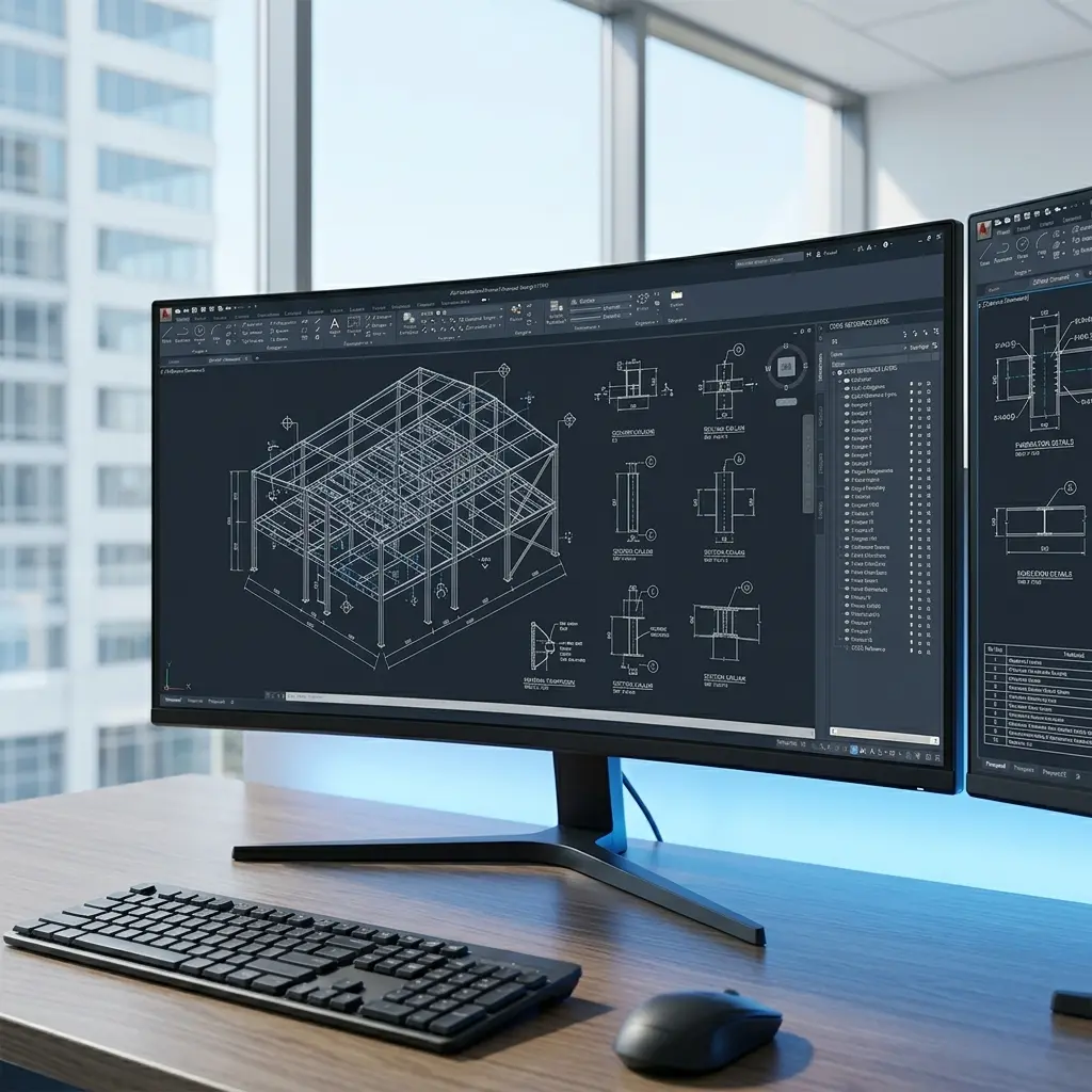
How the Shop Drawing Approval Process Can Speed Up Project Delivery by 30%
A commercial construction project was running late before fabrication had even started. The issue was not a shortage of internal team or material delays, but a slow shop drawing approval process. Multiple revisions and delayed stakeholder response created a bottleneck, but after restructuring the shop drawings approval process with better coordination, the project team reduced the approval cycle by 30% and recovered valuable project time.
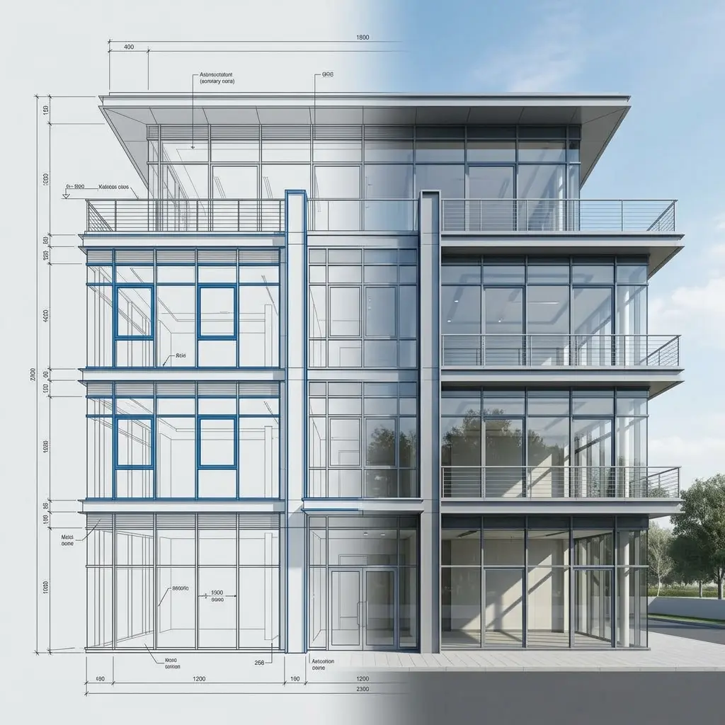
Commercial Facade Design Challenges in Modern Buildings: What Design and Engineering Teams Need to Watch For
Each building today tries to stand out, and most of the time, an attractive exterior is used to create an impact. But commercial facade design serves a higher purpose. These modern building facades are expected to perform on multiple levels. Energy efficiency, thermal performance, constructability, sustainability, and post-construction maintenance- all are expected to work together perfectly.
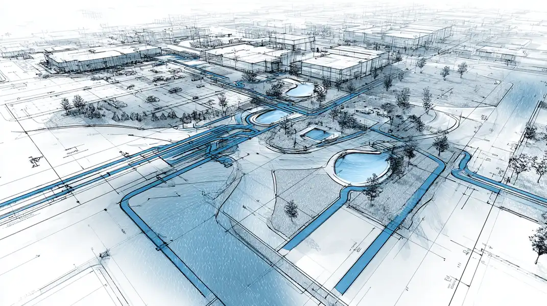
How Outsourcing Stormwater Drainage Design and Drafting Save Time and Money for Civil Engineering Firms
Imagine that your civil engineering firm is handling multiple land development projects at once, each with tight submission deadlines, utility coordination issues, and multiple drainage revisions. But your internal team is already juggling site planning, design review, and project meetings, while drafting Stormwater drainage consumes time and resources.

How Plumbing Drafting Outsourcing Helps Contractors Reduce Costs by 20–30%
Are plumbing drafting costs quietly eating into your project margins? Budget overruns rarely come from a single issue- they build up through small inefficiencies. Rework caused by coordination gaps, delays in updating drawings, and the cost of maintaining in-house teams during fluctuating workloads all add up.

Cut Approval Timelines by 30% with Accurate Residential Site Plan Drafting
Are you facing delays in residential site plan approval? Delays in approvals aren’t just frustrating, but they directly impact project cash flow, time to market, and resource allocation. The significant portion of delays happens due to drafting inaccuracies and compliance gaps.

Is Electrical Drafting Outsourcing More Cost-Effective for Large Projects?
Is your in-house electrical drafting team keeping up as your projects scale, or quietly slowing things down? For large projects, electrical drawings directly impact timelines, coordination, and overall costs. Drawing volumes grow, multiple teams come into play, and even a strong in-house setup starts feeling stretched. Deadlines tighten, revisions increase, and managing workloads becomes more challenging.

6 Common Grading Plan Mistakes That Can Delay Your Project
A grading plan isn’t just lines and elevations, but it helps to keep your entire project moving forward. Yet small grading errors can put your entire project on hold, result in failed approvals, and costly rework down the line. From drainage miscalculation to missing site details, these mistakes go unnoticed until it’s too late.

Hidden Costs of In-House MEP Drafting That Contractors Often Overlook
For many contractors, keeping MEP drafting in-house feels like the most cost-effective and controlled option. You have your team, your tools, and your processes- everything under one roof.
(Enter captcha image text in box)