Terrestrial Laser Scan (TLS) formats
- Leica RCP, PTS, PTX, IMP
- FARO FLS, FWS
- Trimble TZF
- Riegl RIEGL DAT
- Autodesk ReCap RCS, RCP
Convert LiDAR laser scan and point cloud data into editable CAD drawings or coordinated Revit BIM models at LOD 100 to 500. Your reality-capture, design, and FM teams stay focused on scan strategy, coordination, and renovation planning, not manual model creation. Direct employees only. ISO-certified.
Weekly converted files
Jobs completed monthly
Active Clients
CAD Drafters
 9001:2015
  27001-2022
  19650-1:2018
  14001:2015
  45001:2018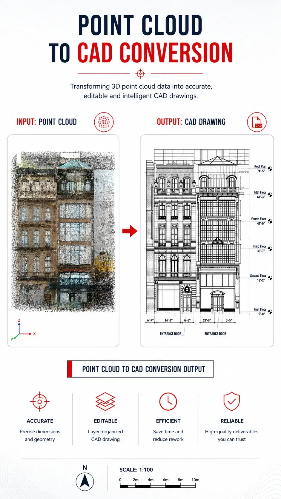
Gsource works directly from raw scan data or from registered point cloud files depending on client’s preferred handoff format.
We transform 3D LiDAR laser scan data into editable CAD drawings or coordinated Revit BIM models and deliver them at the CAD/Revit template (LOD 100 - 500), standardized to your firm.
Delivered at production scale: 1,000+ BIM models delivered monthly by a bench of 50+ dedicated BIM specialists, at 98% conversion accuracy.
Not sure which output fits your project?
Numbers our clients hold us to, measured across every drawing and model we deliver.
On-time delivery
Drawing sets delivered on the schedule agreed at project kickoff, so your permit submissions and downstream project timelines stay on track.
Drawing accuracy
Verified against internal QC checklists and applicable code requirements before a set ever reaches your desk.
First-time client approval
Drawing sets approved by architecture firms on the first review round, with minimal revision cycles needed.
Revision request rate
Requests for rework after delivery, a reflection of the accuracy built into the drafting process from the start.
Mixed scanners, some registered, some raw stations, and we needed clean Revit at LOD 300. Gsource took the messy point cloud and gave us coordinated models our design team could build on. The sample floor plate before full scale-up saved us from a costly misalignment.
We scan; we don't draft. Gsource runs the point-cloud-to-CAD production behind us for our commercial clients, delivered to each client's template under our brand. It let us sell as-built deliverables without building a modeling team.
Clients are anonymized under NDA.
Our senior scan-to-CAD team has decades of combined experience across TLS, mobile mapping, aerial LiDAR, and photogrammetry workflows. We work with the actual point cloud data, not just proxy exports.
Whether you need editable CAD floor plans or a federated Revit BIM model, both delivery paths live under one engagement. Change scope mid-program without switching vendors.
Deliverables in your firm's CAD/Revit template, layer conventions, and BIM naming standards. LOD targets set at engagement start, held throughout the program.
Point cloud files often exceed 100 GB. Secure large-file transfer, ISO 27001-controlled storage, NDA on every engagement. Direct-employee model, no subcontractors.
Clearly defined deliverables and fixed-scope milestones.
Ongoing technical support and on-demand expertise.
High-volume, multi-disciplinary, long-term integration.
Adaptive workflows & complex, evolving project requirements.
Review your scan data (TLS, mobile mapping, aerial, or mixed). Confirm registration quality, coverage, and coordinate system. Map your CAD/Revit template, LOD target, and BIM naming standards. Sign NDA and confirm IP terms.
If raw scan station data provided, register into unified point cloud. Clean noise, remove artifacts, verify coordinate accuracy against control points.
Deliver a small sample area (single floor, single zone) for your team to validate against your standards before full-scale production.
Senior-led production of 2D CAD or 3D BIM deliverables. Weekly progress reviews. Multi-discipline coordination if federated BIM output.
ISO 9001 quality checks against your standards. Multi-discipline clash detection if BIM output. Native format delivery (DWG, RVT, IFC, NWC as needed) with source point cloud, registration report, and QA log.
No tool retraining. We adapt to your standards.
Working with a specialized CAD or FM platform? We integrate with Archibus, Tririga, FAMIS, IBM Maximo, and most enterprise FM/CAFM systems.
We'll scope your scan volume and target output, walk through similar reality-capture programs, and share a vendor onboarding pack within one business day of a mutual NDA.
(Enter captcha image text in box)