Optimizing Stormwater Management Through Drainage Area Mapping
Introduction
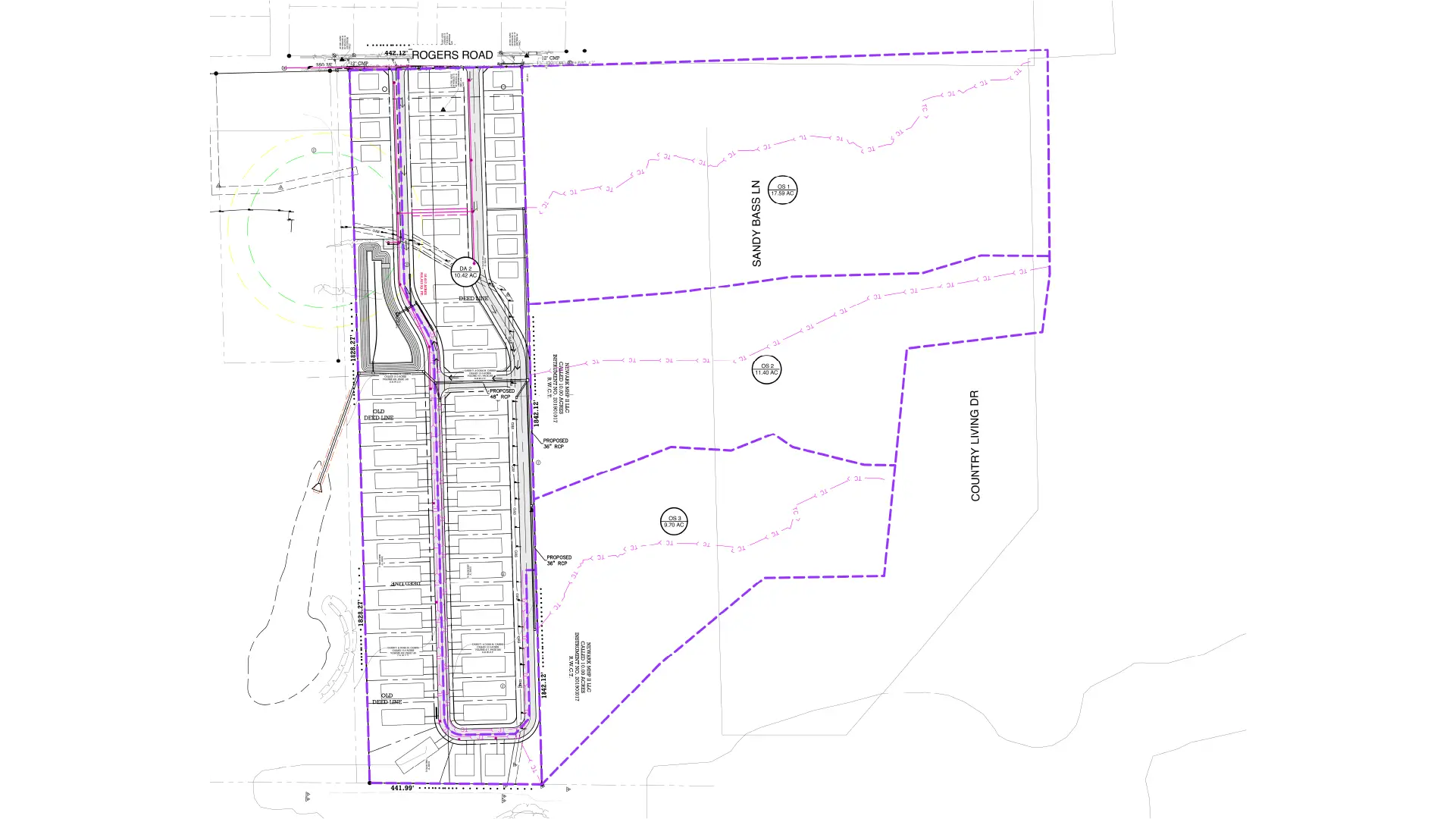
Key Challenges
- Complex Topography
Varying natural slopes and elevations makes it difficult to define clear drainage boundaries.
- Integration with Proposed Grading
Ongoing grading plans altered the natural flow path, which need continuous updates to drainage mapping.
- Data Accuracy Issues
Inconsistent or outdated survey data impacted initial boundary of watershed delineation.
- Multiple Discharge Points
Identifying and managing multiple outfall locations while maintaining flow efficiency.
- Regulatory Compliance
Ensuring adherence to local Stormwater management and environmental regulations.
Approaches and Solutions
- Advanced Topographic Analysis
Utilized high-resolution survey data and contour mapping to accurately identify flow directions.
- Watershed Delineation Techniques
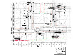
Divided the site into smaller and manageable sub-catchments for precise analysis.
- Use of CAD and GIS Tools
Implemented software tools to automate flow path identification and improve mapping accuracy.
- Dynamic Coordination with Grading Plans
Regular coordination with the grading design team to know real-time changes in drainage flow.
- Flow Path Optimization
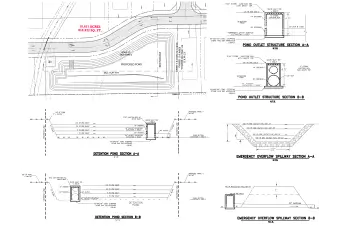
Designed a logical drainage path to channel runoff towards designated collection and discharge points.
- Validation and cross-checks
Performed multiple validation checks to ensure accuracy and consistency across all drawings.
Final Outcome
-
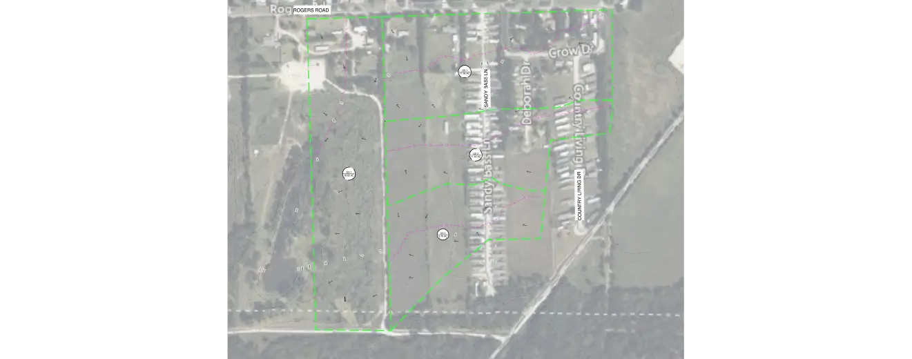
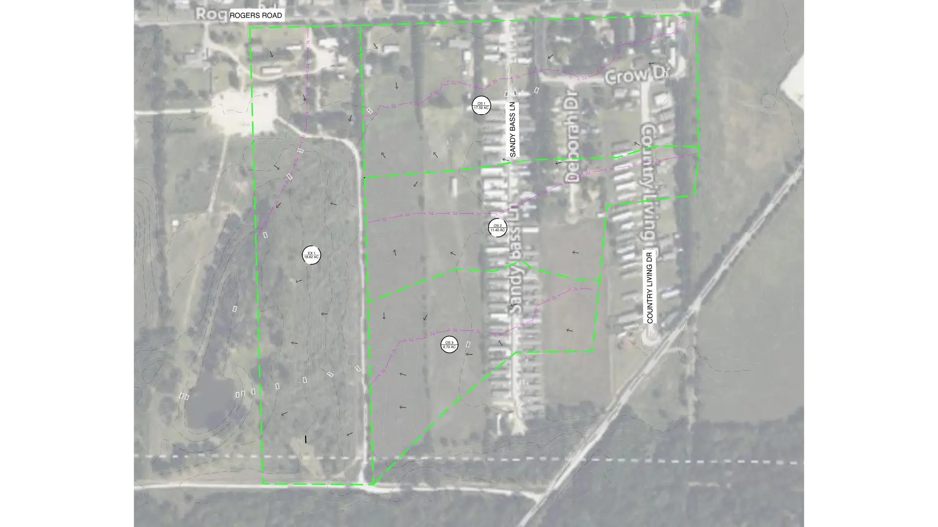
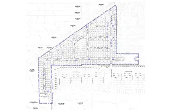
Clearly defined drainage areas and sub-catchments across the 130-acre site.
-
Improved Stormwater flow management aligned with grading and infrastructure design.
-
Accurate base for further hydraulic and Stormwater design calculations.
-
Reduced risk of waterlogging and flooding.
-
Fully compliant drainage map ready for approval and construction use.
Client Overview
The client is a land development firm specializing in large-scale residential projects. Required precise and coordinated design documentation to streamline approvals and constructions. Designed reliable drainage mapping solutions that support overall site development efficiency.
Plan Smarter Stormwater Systems with Accurate Mapping
Get precise insights into drainage patterns and improve overall site performance.

Nabil Shaikh is the Senior Accounts Manager at Gsource Technologies, overseeing key departments including land surveying, civil engineering, and signage design. With a strong understanding of multidisciplinary workflows, Nabil ensures seamless coordination between teams and clients, driving projects toward successful outcomes. Known for his detail-oriented approach and commitment to delivery, Nabil plays a crucial role in strengthening client relationships and ensuring consistent project performance.
Related Case Studies
(Enter captcha image text in box)