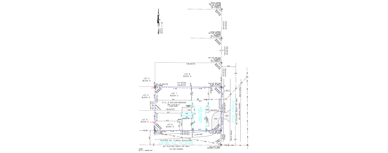
Fence Placement Verified for Legal Compliance Using a Monument-Based Boundary Survey
Introduction
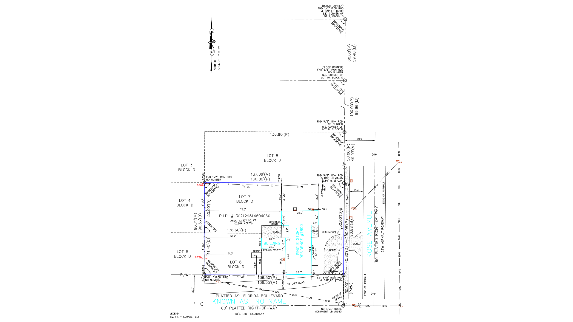
Key Challenges
- Outdated Plat Data:
The subdivision plat lacked bearings and angles, complicating direct boundary reconstruction.
- Limited Field Control:
Few accessible monuments were available onsite for orientation.
- Ambiguous Fence Position:
The fence’s proximity to boundary lines required precise measurement for legal clarity.
Approaches and Solutions
- Monumentation Strategy:
Located and tied available field monuments (PCs and PIs) to reconstruct property boundaries.
- Lot and Block Verification:
Confirmed parcel boundaries using subdivision plat references consistent with the Lot and Block Method, supported by deed descriptions.
- Visual and Legal Integration:
Combined field survey data, plats, and legal records for enhanced positional accuracy.
- Setback Compliance:
CAD drawings were annotated with county setback and easement details for clear zoning adherence.
- Quality Assurance:
Populated deliverables using standardized templates with complete property and ownership details; all outputs underwent checklist-driven QA.
Final Outcome
The fence was verified to be within the legal property limits. Its exact location was dimensionally tied to the reconstructed boundary, ensuring compliance with county ordinances. The client received accurate, code-compliant survey drawings in CAD and PDF formats for legal reference and long-term record keeping.
Client Overview
The client, a California-based residential property owner, required professional boundary validation to resolve a fence dispute.

(Enter captcha image text in box)