
Accurate Property Line Verified Using Boundary Survey and CAD Drafting
Introduction

Key Challenges
- Legal vs Actual Discrepancy:
A 3-foot deviation between deed and physical survey raised ownership concerns.
- Missing Monumentation:
Lack of visible boundary markers impeded initial field alignment.
- Erroneous Legal Description:
Bearings and distances in the legal document were inconsistent.
- Limited Local Survey Controls:
Absence of rotational reference added complexity.
- Need for Visual Encroachment Verification:
The client required clear proof of shed placement beyond legal limits.
Approaches and Solutions
- Legal Review and Corrections:
Cross-verified deed data with neighboring parcels to rectify errors.
- Data Enhancement:
Requested additional control points and used visible features to anchor boundaries.
- CAD Drafting & Rotation Testing:
Simulated rotation alignments in CAD to ensure precision.
- Visual Mapping:
Tied all improvements (shed, fences, etc.) to boundary lines and easements.
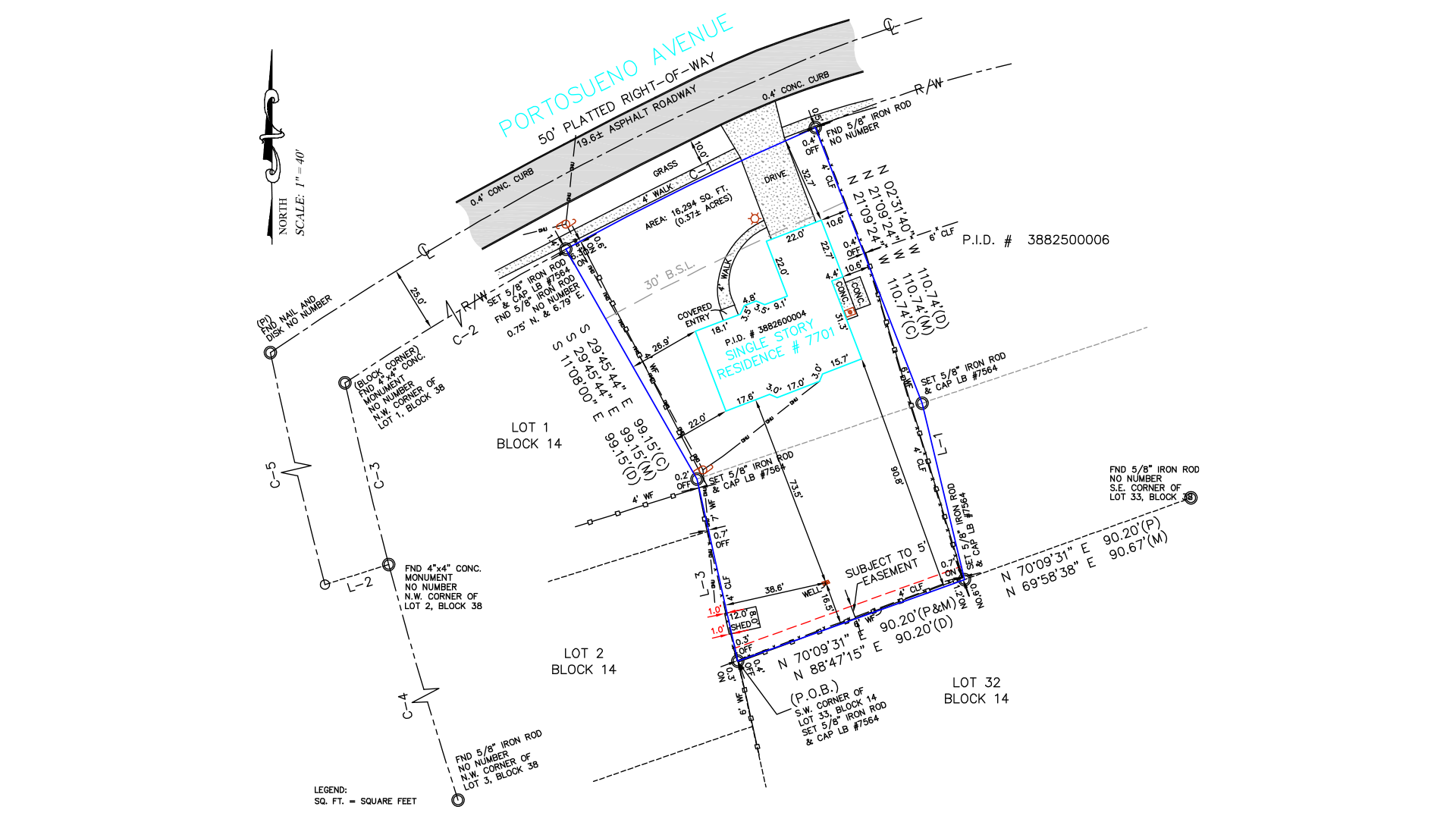
Final Outcome
Gsource delivered a detailed boundary survey confirming a 1-foot shed encroachment. The discrepancy was visually highlighted, documented, and shared with the client for resolution and compliance.
Client Overview
A Florida-based homeowner seeking to validate property limits and resolve a potential encroachment issue during home renovations.

(Enter captcha image text in box)