


Need High-Accuracy GIS Maps for Your Next Project?
Talk to our GIS specialists today.

Turning Location Data into Real-World Impact
At Gsource, we transform your geospatial data, including UAV imagery, LiDAR scans, GPS coordinates, CAD files, asset inventories, and field observations, into precise, analysis-ready GIS maps and spatial datasets that support engineering, infrastructure planning, utility management, land development, logistics, and environmental monitoring. With 17+ years of global geospatial expertise, a 350+ multidisciplinary team, ISO-certified production workflows, and a 99% client satisfaction rate, we deliver end-to-end GIS Mapping solutions that ensure accuracy, scalability, and complete alignment with your project requirements and coordinate systems.
 9001:2015
  27001-2022
  19650-1:2018
  14001:2015
  45001:2018
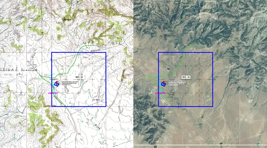
30% faster turnaround for large-scale GIS mapping and geospatial processing
High-accuracy 2D/3D datasets with <5 cm positional variance
24/7 collaboration with expert GIS, LiDAR, and photogrammetry teams
Guaranteed compliance with GIS standards, projections, and asset schemas
Up to 40% cost savings through automation and reduced field revisits
Transforms addresses or place names into precise geographic coordinates for accurate mapping, analysis, and location-based insights.
Represents Earth’s surface, including buildings and vegetation, capturing elevation variations for terrain analysis and planning workflows.
Creates detailed 3D surface geometry using interconnected triangles for realistic visualization, simulation, and spatial decision-making.
Converts geospatial datasets between formats, projections, or schemas to maintain compatibility, accuracy, and smooth data integration.
Extracts high-resolution textures from imagery to enhance realism in 3D models, renderings, and environmental visualizations.
Generates precise vector features- points, lines, polygons- from imagery or scans for mapping, analysis, and asset management.
Processes and transforms ortho-rectified images into required formats, projections, or resolutions for mapping, surveys, and GIS workflows.
Get tailored solutions to fit your project’s scale and complexity
Clearly defined deliverables & fixed-scope milestones.
Ongoing technical support & on-demand expertise.
High-volume multi-disciplinary, & long-term integration.
Adaptive workflows & complex, evolving project requirements.
Talk to our GIS specialists today.
Multi-level QC for error-free as-built drawings.
Skilled professionals with deep industry experience.
Confidentiality maintained with strict protocols.
Precision and accuracy delivered on tight schedules.
High-quality services without breaking your budget.
Aligned with ISO 9001 and ISO 27001 for consistent quality.
Single point of contact with real-time updates throughout the project.
Clean, organized files with quick help for any updates after delivery.
Get expert support to streamline your next project.

Free Initial Consultation - No Commitment Required

Secure and Confidential Project Information

17+ Years of AEC Expertise

450+ Drawing Deliverables Daily

Industry Standards Compliance Guaranteed
Gsource’s GIS mapping services package includes spatial data integration, analysis, 2D/3D map creation, geospatial modeling, and customized GIS solutions tailored to industry-specific workflows.
To begin your GIS mapping project, simply schedule a consultation with Gsource. Our team reviews your data, requirements, and objectives to create a clear project scope, workflow, and delivery timeline.
Yes. Gsource provides fully digital GIS mapping services with outputs optimized for platforms like ArcGIS, QGIS, AutoCAD, Civil 3D, and enterprise geospatial databases for seamless integration.
Absolutely. Gsource supports GIS mapping for small sites, multi-city regions, large infrastructure networks, and enterprise-level geospatial systems, ensuring accuracy and consistency across all scales.
Yes. Gsource offers end-to-end support, from initial consultation and data cleanup to system setup, training, and deployment for beginners and non-technical teams.
Yes. Gsource specializes in LiDAR-enabled GIS mapping, delivering high-resolution 3D terrain models, point cloud classifications, and elevation datasets with industry-leading accuracy.
Definitely. Gsource processes UAV/drone imagery, photogrammetry data, and orthophotos to produce georeferenced maps, DSM/DTM models, and feature layers for GIS applications.
Yes. Gsource offers GIS mapping solutions for utilities, roads, railways, pipelines, and infrastructure planning, supporting asset management, route optimization, and condition analysis.
Gsource follows ISO-certified workflows, projection control checks, topology validations, and QC audits to ensure accuracy, spatial consistency, and regulatory compliance across large datasets.
Yes. Gsource develops interactive geospatial dashboards and web map portals using platforms like ArcGIS Online, Mapbox, and open-source tools for real-time visualization and decision-making.
(Enter captcha image text in box)